
NASA · Wed, 30 Sep 2026 04:01:00 GMT
Powerful Storms Continue to Prowl the Pacific
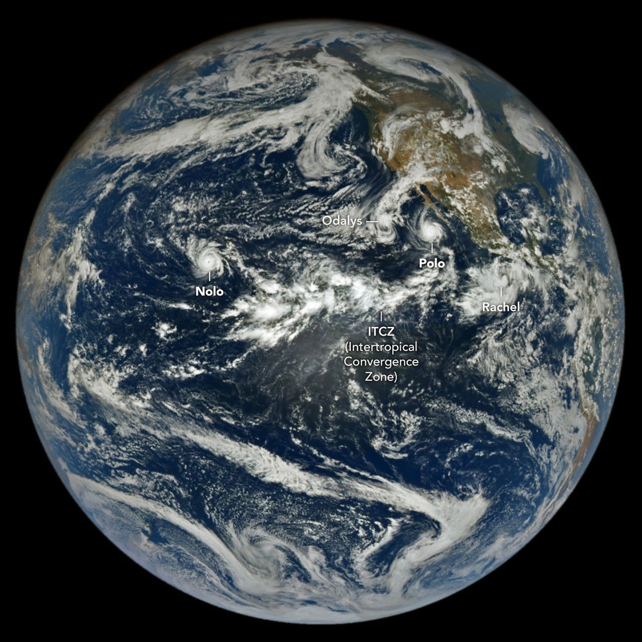
Hurricanes Polo and Nolo sent destructive effects ashore amid an active season in the northeastern and central Pacific.
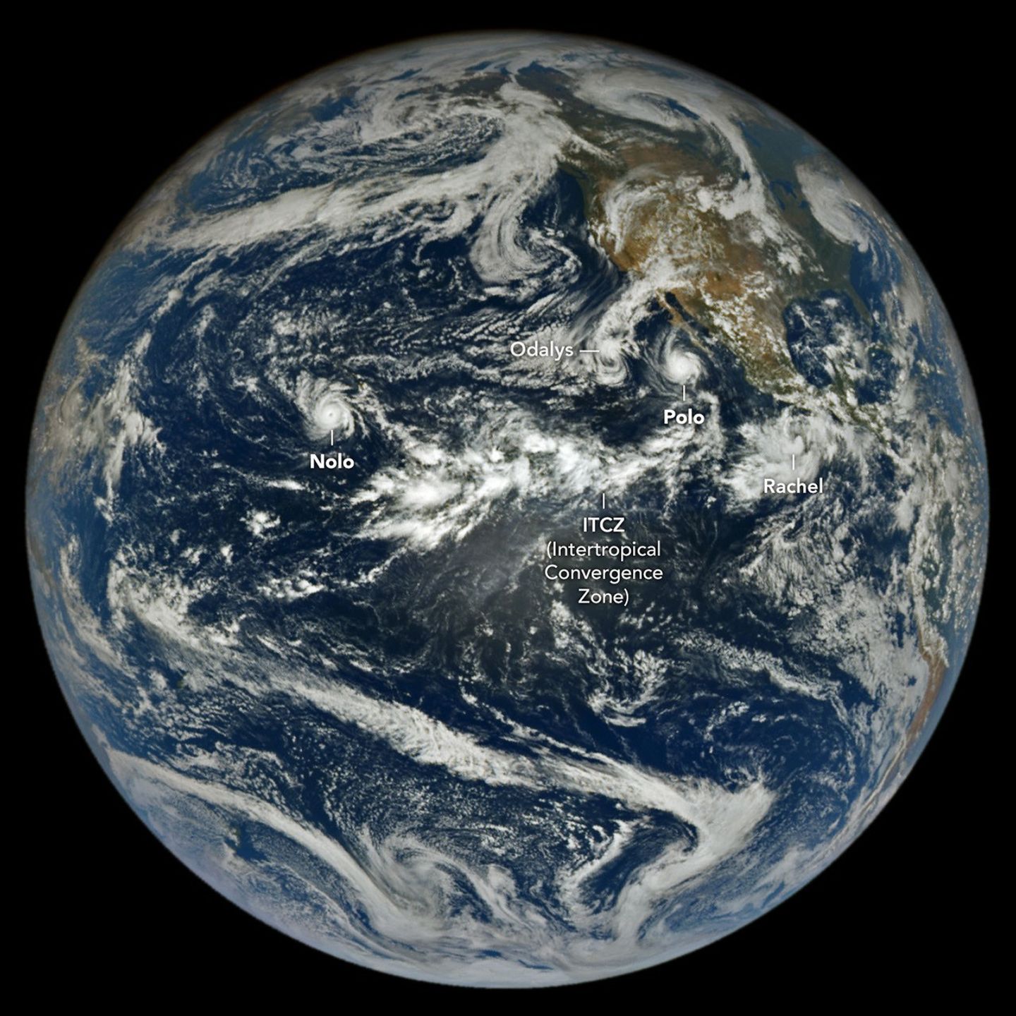
The 2026 tropical cyclone season in the northeastern and central Pacific basins has been busy. By September 28, the number of named storms in the region had grown to 20, of which nine had reached hurricane strength. For comparison, the 1991-2020 average by that date is 13.5 named storms with 7.4 hurricanes.
An image from NASA’s EPIC (Earth Polychromatic Imaging Camera) on the DSCOVR (Deep Space Climate Observatory) satellite, acquired on September 27, shows the basin again rife with powerful storms. Hurricane Nolo near Hawaii and Hurricane Polo off the Baja California peninsula were lashing land with high winds, storm surge, and heavy rain. On either side of Polo, Tropical Storm Rachel and Post-Tropical Cyclone Odalys were contributing to treacherous conditions along the Mexican coast and in the southwestern U.S., respectively.
Hurricane Polo (below) made landfall in Baja California Sur around 11 p.m. local time on September 28 (06:00 Universal Time on September 29). Before encountering land, the storm had undergone extreme rapid intensification while churning over the unusually warm ocean surface, catapulting to category 5 status on September 22. Polo waned in intensity on its approach to the coast and likely made landfall as a category 2 storm, according to the National Hurricane Center (NHC).
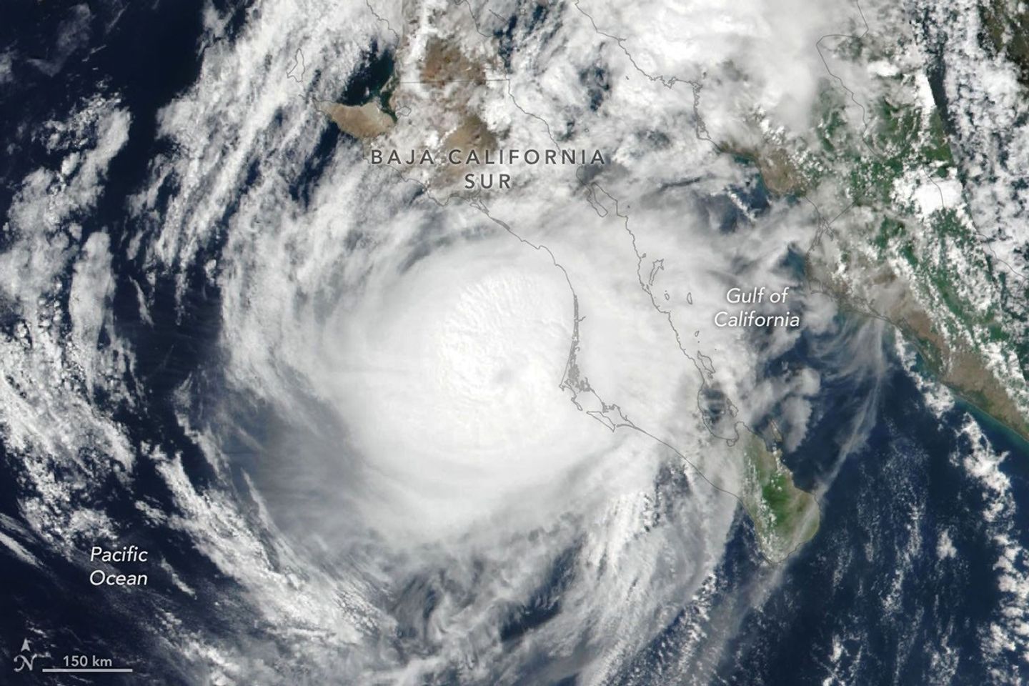
Polo then continued across the peninsula and the Gulf of California and made a second landfall , near Guaymas, as a further weakened system around midday on September 29. The NHC warned of dangerous winds and storm surge, as well as heavy rains capable of triggering flooding and mudslides in parts of Baja California Sur and Sonora.
The hurricane’s effects were expected to be even more widespread. Polo and its remnants, combined with moisture from Post-Tropical Cyclone Odalys, were likely to push over the southwestern U.S. and southern Plains over several days, forecasters said , fueling yet more heavy rain and flood risk. Next in the train of storms, Tropical Storm Rachel was tracking parallel to the southwest Mexico coast, where the NHC forecast strong winds and dangerous surf and rip current conditions.
Meanwhile, the third hurricane of the season to pass close to Hawaii was delivering yet another deluge to the islands. Hurricane Nolo , though it did not make landfall, dropped more than 12 inches (30 centimeters) of rain on parts of Maui and the Island of Hawaiʻi. The storm flooded roads, toppled trees, and triggered landslides, according to news reports , but the Island of Hawaiʻi was spared some of the more severe effects wrought by Hurricane Lala in mid-August.
As of September 28, the accumulated cyclone energy in the Northeast Pacific was more than twice the norm , according to data from Colorado State University . Scientists expect an increase in tropical cyclone activity in this ocean basin during an El Niño , which has been underway since June. Warm water in the equatorial Pacific and low wind shear in the region, both typical El Niño patterns, encourage tropical storms to develop and strengthen.
The NASA Disasters Program , in coordination with FEMA, is supporting the State of Hawaii's response to Hurricane Nolo. The team will be posting maps and data products on its open-access mapping portal as new information becomes available.
NASA Earth Observatory images by Lauren Dauphin, using data from DSCOVR EPIC and VIIRS data from NASA EOSDIS LANCE , GIBS/Worldview , and the Suomi National Polar-orbiting Partnership . Story by Lindsey Doermann.
Downloads
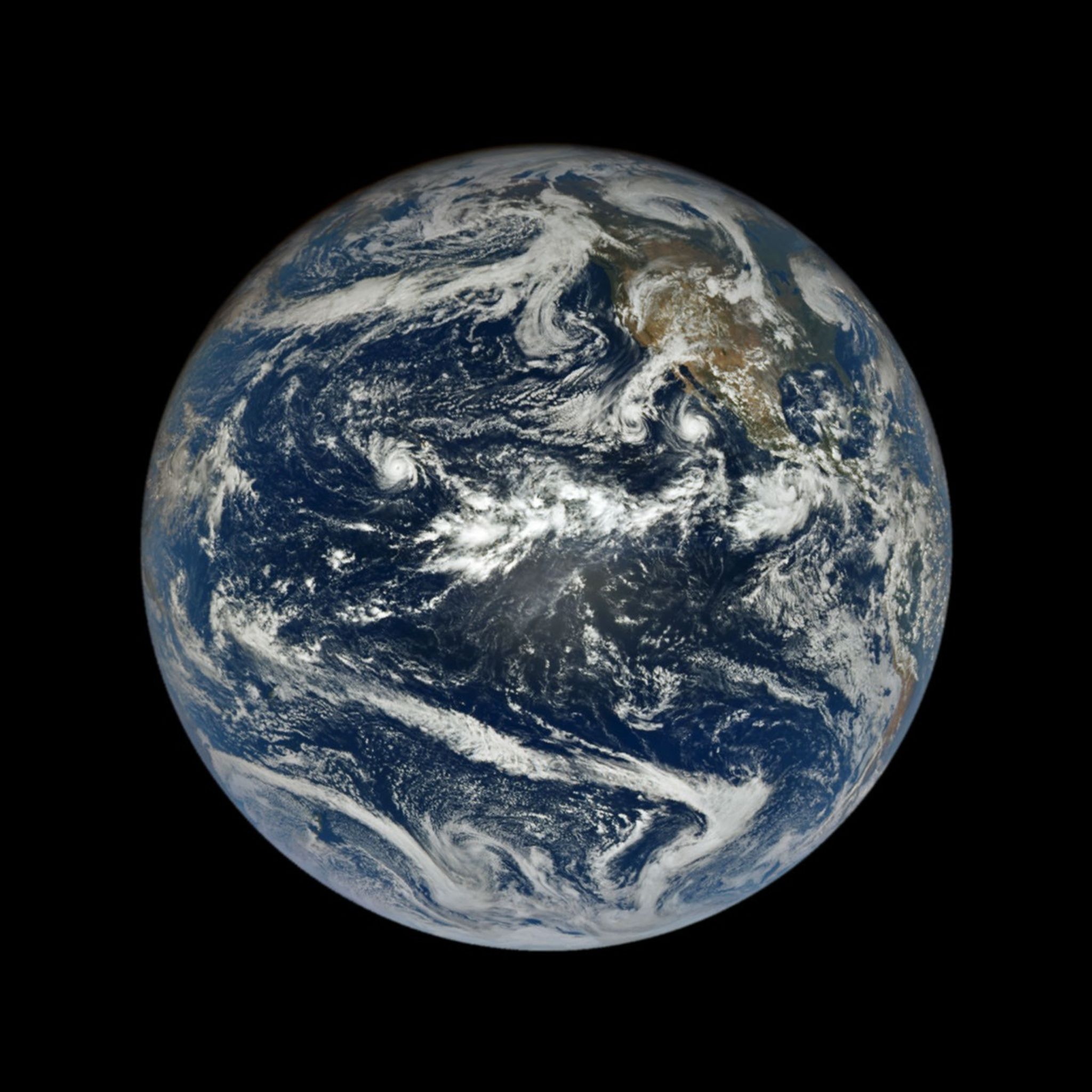
September 27, 2026
September 28, 2026
References & Resources
You may also be interested in:
Stay up-to-date with the latest content from NASA as we explore the universe and discover more about our home planet.

The powerful storm delivered extreme rainfall and damaging winds to the state, passing the Island of Hawaiʻi as a category…

Several ingredients came together off the Pacific coast of Mexico to generate one of the strongest storms the eastern Pacific…
The Pacific was buzzing with storms while the Atlantic was notably quiet.
Discover More from NASA Earth Science
Subscribe to Earth Observatory Newsletters
Subscribe to the Earth Observatory and get the Earth in your inbox.
Earth Observatory Image of the Day
NASA's Earth Observatory brings you the Earth, every day, with in-depth stories and stunning imagery.


Earth Science Data
Open access to NASA’s archive of Earth science data

Published by NASA. NASA content is not subject to copyright; NASA does not endorse Everything Space. View the original →
What do you make of it?
Nobody has weighed in on this story yet.